A buddy took me out yesterday to see how high we could get before hitting the snow level. We headed out to Cowiche Mill road first. We went back quite a ways until my buddy wanted to stop because it got too rocky for him. I went ahead to check it out and it reminded me of the pictures people post about the WABDR and the dreaded babyhead rock hill. I was told this trail leads to or is part of the WABDR route. It wasn't too bad going up, but coming down was a little more sketchy. Very loose with the moving rocks. By the time we got to that section we had gone thru several areas with snow, ice and mud covering the road. We will have to wait for another month or 2 to continue on.
We then headed over to BBQ Flats west of Wenas which was closed off for another month or so. We tried going to the Manastash Observatory which had double gates blocking access. I think the sign said May 1st for the opening. After that closure we headed over to Manastash road and headed to Quartz mtn. We got stopped after going thru several sections of snow, ice and mud by solid snow and ice covering the road at about 3300 feet elevation. It'll probably be sometime in June before we can get to Quartz Mtn
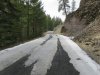
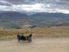
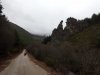
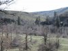
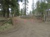
Cowiche Mill road
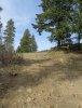
I know it doesn't look steep but it is and just around the corner is where the baseball sized babyhead rock section starts.
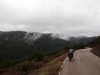
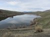
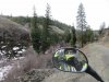
Wenas lake
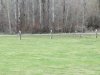
We went by a big flock of Turkeys (15-20) pretty quickly. Several were showing all of the tail feathers spread out. By the time I turned around and got stopped for the picture, they all ran off. These were really camera shy.
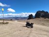
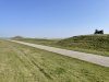
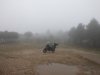
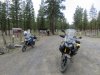
BBQ Flats parking lot
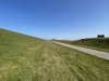
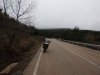
This is the road to the Manastash Observatory. Note the big yellow gate in the background.
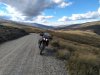
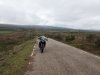
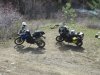
This is on Manastash road headed to Quartz mtn.
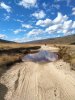
And the end of this road for us today. Up past the bare section is solid snow and ice. There were tracks in the mud from recent 4x4's with chains on. Another good sign to stop our forward movement.