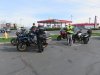
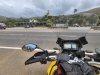
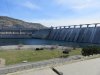
Our Next stop was the Grand Cooley dam that was started in1935. The water lever was low enough that it wasn't flowing over the dam. The guys were telling me that the water level was really low for this time of year. Again notice the really smooth water.
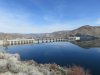
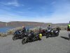
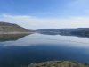
Looking east north east up the Columbia river.
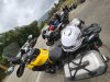
We ate lunch on the lower side where they do the laser light shows on the spillway.
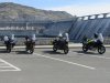
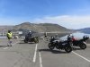
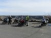
When we were getting ready to leave a guy rides up on Harley trike and started talking to us. Come to find out he worked on the Dam extension on the far side for 26 years. He is still riding at 87 yrs old. Unfortunately no one got a picture of him or his shiny black trike.
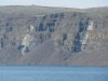
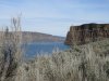
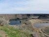
We back tracked along Banks lake to Dry Falls. This is a 3.5-mile-wide chasm of basalt, with a drop of 400 feet. It is also left over from the ice age floods. If water continued to flow here, it would be twice as high and five times the width of Niagara Falls. There is lots of interesting history to read about this area.
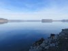
Yes there are boaters on the water down there.
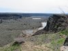
This is looking down stream
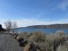
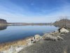
We stopped by Soap lake. Which at times during windy days can have a big layer of soapy bubbles on the shore line.
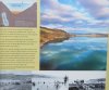
From Wikipedia about the lake - Of the five lakes existing along the Coulee Corridor,
Soap Lake has the highest mineral content. The first layer of Soap Lake is made up of about 81 feet of mineral water; the second level is mud-like and consists of a stronger mineral composition with concentrations of unusual substances and microscopic life forms. The lake's two layers have not mixed in thousands of years. The scientific community refers to lakes with this rare condition as meromictic. With only 11
meromictic lakes in the United States, Soap Lake is likely the most radical of all.
And finally, on the way way home thru the now greener Yakima river canyon.
")