I take a shot at this....
Broadly speaking, both tracks and routes are paths on the earth's surface you can follow. On the Garmin systems, the difference is more/less is that a route is a sequence of "via points" (which may be "waypoints" - more on this later) that the route has to go through while a track is a set of bread crumbs laid down by the GPS as it navigates.
A "direct route" is one that simply draws straight lines between via points in sequenc. An "auto-route" is one in which the application or GPS uses some sort of optimization algorithm to find a road path that goes through the via points in sequence.
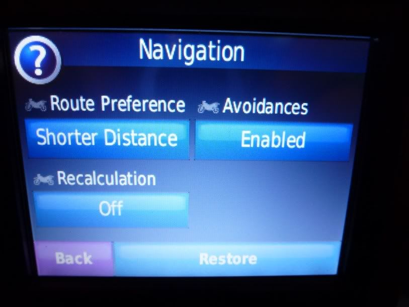
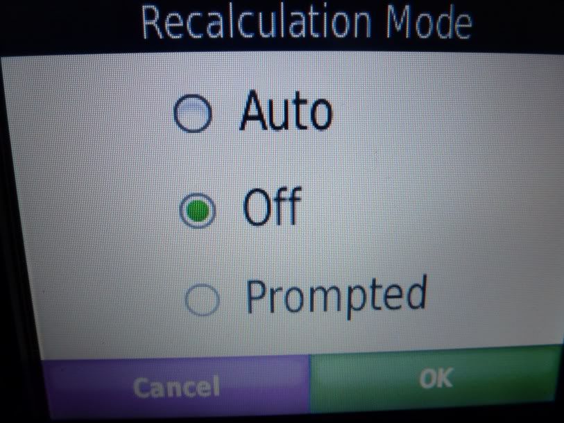
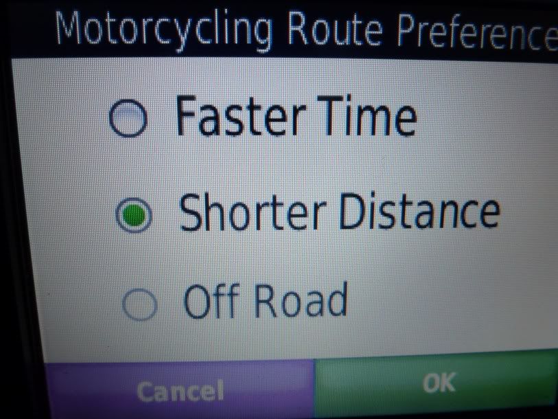
The route that is built from a given set of via points will vary from application to application and GPS to GPS depending on route preferences and priorities. Both the application (e.g., Google Maps or Basecamp) or the GPS will typically have a "routing preferences" section where you can define what you want to optimize with the route and what you want to avoid. (As an aside, I have found routing to be totally unpredictable when you start setting unusual preferences or start using avoids. For example, the GPS will happily route you 500 miles out of your way to avoid a $0.50 bridge toll if you tell it to avoid toll roads.)
Tracks are more like the breadcrumbs in Hansel and Gretel. They're typically made by actually driving along and having the GPS lay down breadcrumbs as you travel. At pre-defined intervals (either by time or distance), the GPS will note your current location and add the point to the track. When you're done, you have a breadcrumb record of where you've been. Tracks will typically have many more points in them than a route since the GPS marks a location at intervals whether it is needed to or not. A route between two points on a major highway may have only two via points (beginning and end), while a track of the same path may have thousands of intermediate points every mile or two.
You can navigate either a route or a track stored in your GPS, but you do it differently. For a route, you typically "activate" the route, and the GPS will provide you guidance as you drive to stay on the route. For an "auto route" the GPS find a path through the road network that goes through the via points in the route - this is often where the route you had on your computer and the route in the GPS do not compute exactly the same, which is a huge source of confusion to many users. You can minimize this problem by including sufficient via points that constrain the optimization to be similar and by making sure you use the same preferences on both the computer and the GPS. Some GPSs (e.g., the Zumos) seem to match up better - I think they use extra information in the route between the via points you've defined to do a better job matching the routes. BTW, not all maps support auto-routing. If you're using routes on a map that doesn't, you have to use direct routes.
Navigating a track is simpler - you just display the track on the screen and do what you need to do to follow it. The track display simply draws a straight line between the points defining the track, but because the points are typically close together, you are never too far from the track. But there is no guarantee that there will be a point where you need to make a turn, so there is more trail-error and intuition involved in track following. With auto-routes, you get explicit turn-by-turn guidance since the GPS reconciles the underlying road network and the route.
Typically, routes are more suitable for road navigation and tracks more suitable for backwoods navigation. There are applications on the net that convert back and forth between tracks and routes with mixed results.
On Garmin systems, a "via point" is a point in an route that forces a route to go through the point. When you're building a route and move it around, via points are added as necessary to constrain the route to go through the places you want to go. Via points are strictly a route concept - a point on a route to force the route to go through it.
A waypoint is something you define as a location you have interest in (e.g., a gas station, a landmark, etc.) You can name them, give them symbols, etc. You can include a waypoint in a route in which case it is a via point for that route. But you can build a route with just via points.
When you transfer a route between the PC and the GPS, all that is typically transferred explicitly is the via point sequence. The GPS builds the actual route when you navigate it. As I said before, this leads to discrepancies. Some Garmin GPSs appear to also transfer "hidden via points" to reduce this problem of routes in the computer not matching routes on the GPS, but I know my 60-series does not.
You can use applications like Google Maps and Streets and Trips to build routes, export to GPX files, open these files in programs like MapSource and Basecamp, and then transfer the routes to the GPS. But you're going through lots of translation steps and it takes some trial/error to find out what works with your particular systems.
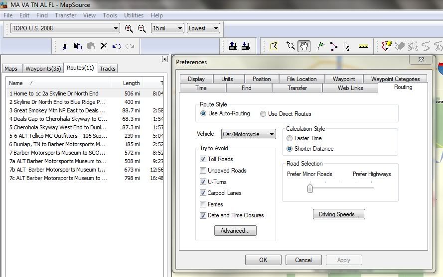
I've tried to build routes in Google Maps before, but the system is so flacky and bug-ridden, I usually give up so I can't help you much there. (For serious route-building - not just typing in two addresses and asking for directions - I hate Google Maps with a serious passion.) I do like S&T though and have used it successfully for route building. But mainly, I just bite the bullet and use MapSource or Basecamp. I do agree that the learning curve of these applications is very steep though and they're hardly paradigms of good application design. (But then again, neither is Google Maps.) But I would try and do some simple things with them to get routes to work on your GPS before adding in the complications of importing GPX files.
You mentioned difficultly getting to the maps on your GPS. As I understand it, Garmin sells maps on DVD, built-in to the GPS, and on memory cards. If you don't get the DVD version, you can't use the GPS maps on the PC.
It helps if you have reasonable expectations of how simple this should be with current technology. Building sophisticated routes on the PC, getting them with fidelity to the GPS, and navigation is not child's play. I've been doing it for a decade and it still trips me up now and then.
Hope this helps,
- Mark