Ghost-Town Ride #1
Friday, July 26th 2024
I'll be easing us into the Weekend with a shorter Ride-Day on Friday.
Have all of your Coffee, Breakfast, and morning "Duties" out of the way, and be preparing to Ride around 10:00am.
Anyone that might be Lodging elsewhere (in Town), be prepared to meet us at the Campground around 10:00am.
Please have your Bikes fueled-up already prior to meeting at Camp.
We will depart the Campground (Kickstands-UP) at 10:30am
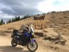
Today's Ride will be 80-Miles total, including 30-miles of easy graded-gravel or hard-packed solid Dirt Road.
*I encourage everyone to wear protective Riding-Boots!*
Be aware that we will be walking around while viewing the Sites.
Either wear Boots that you do not mind walking around in, or have a way to carry a spare pair of comfortable footwear for walking.
We will be away from Town for approx 4-5 hours or so, and I do not have a Lunch-Stop scheduled for this day.
There is no place to buy Food along today's route.
I would encourage everyone to pack some snacks or a lunch to bring with you, that we can eat at one of our stops.
Have a way to bring Water with you as well!
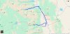
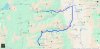
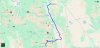
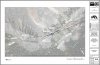
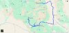
Map of today's destinations:
https://maps.app.goo.gl/pccAHaBHJRoAYx3g9
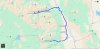
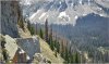
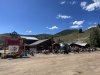
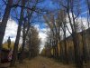
Once we leave the Campground we will head East on Rd-306 towards Buena Vista.
We will turn North onto Rd-361 to bypass the majority of the busy part of Town. (this road is paved)
Once we meet back up with Hwy-24, we will continue North until turning West on Rd-390 at Clear Creek Reservoir.
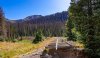
This is where it turns to Dirt/Gravel. this is easy-flat road.
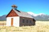
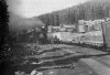
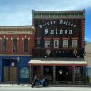
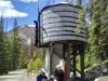
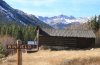
The first Site we come to is the former location of "Beaver City"
Apparently the one Cabin by the road is all that remains of the 20 or so buildings that once stood here.
We'll make a quick stop here.
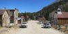
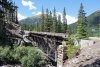
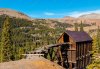
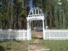
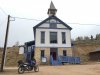
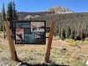
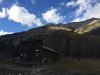
After this we will continue West until we arrive at a small Parking-Area for the Ghost-Town of "Vicksburg"
https://en.wikipedia.org/wiki/Vicksburg,_Colorado
There is a "Museum" here that may, or may-not be open to the public........
We'll spend about an hour here wandering around.
There is also a Vault Toilet across the road at the Missouri Gulch Trailhead, in case anyone needs to use this.
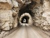
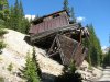
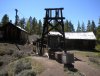
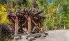
Next we'll continue to head West to "Crescent Mining Camp", which I have also seen referred to as "Rockdale"
https://www.fs.usda.gov/recarea/psicc/recarea/?recid=12461
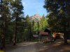
We'll spend maybe a half-hour or so at this location with time to wander around.
The first 2 Cabins are reserve-able by the Forest-Service, and being a Friday will most likely be occupied.
Remind me to tell you a story about this while we are there..................
We can have a snack/lunch break while we are here.
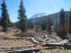
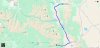
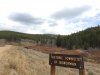
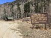
We will continue West from here to the Ghost Town of "Winfield"
https://en.wikipedia.org/wiki/Winfield,_Colorado
There is also a "Museum" here, which also may or may-not be open to the public?
It's neat to peer into the windows also, of the buildings you can see into.
We'll make a stop at the Cemetery, which is just past the Town, before heading back out the way we came.
Maybe spend 45-minutes to an hour or so wandering around.
I'll attach the GPX files in case anyone wants them.